What it is
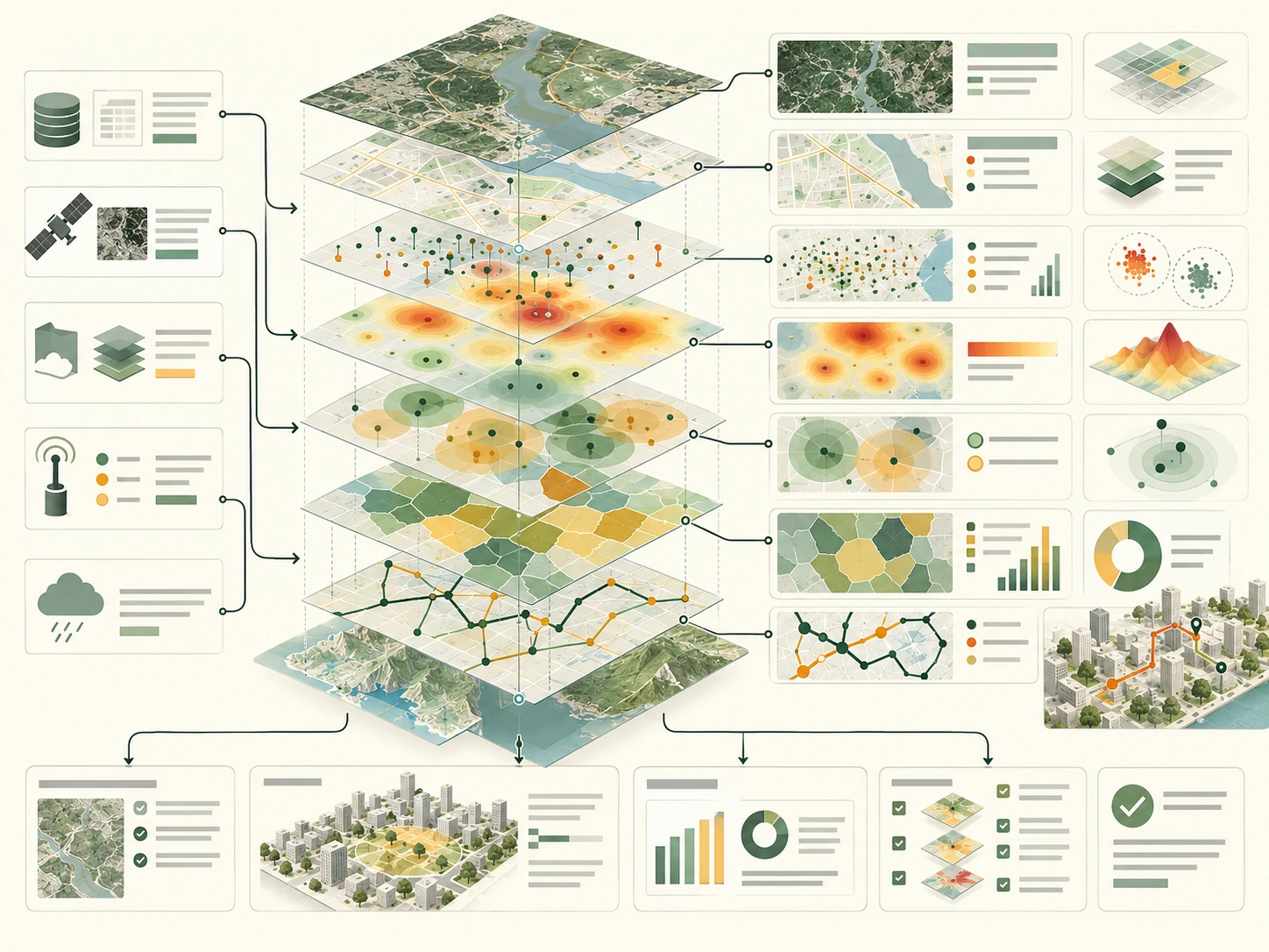
Geospatial analytics combines location-referenced data with methods such as mapping, overlays, distance analysis, network analysis, and spatial statistics. It helps city teams ask where a condition occurs, which services are nearby, and how patterns differ across areas.
How it works
- 01Document coordinate systems, location accuracy, and time coverage.
- 02Join only datasets whose geographic units and permissions are understood.
- 03Choose an analysis that matches the question, such as route distance or service-area coverage.
- 04Inspect results for boundary effects, missing places, and differences in data collection.
- 01
Document coordinate systems, location accuracy, and time coverage.
- 02
Join only datasets whose geographic units and permissions are understood.
- 03
Choose an analysis that matches the question, such as route distance or service-area coverage.
- 04
Inspect results for boundary effects, missing places, and differences in data collection.
Why it matters
Averages across a whole city can conceal local service gaps or exposure. Maps make those patterns visible, but boundaries, scale, and missing data can change the story. Spatial results should be interpreted with residents and domain experts.
Typical Smart City applications
- Mapping transit access and service coverage
- Locating infrastructure risks and work orders
- Comparing environmental exposure
- Reviewing emergency response routes
Example data inputs
Strengths
- Connects records that refer to the same places
- Shows local variation hidden in citywide averages
- Supports transparent maps and repeatable spatial queries
Limitations and risks
- A mapped pattern does not prove its cause.
- Coarse or inaccurate locations can distort neighborhood comparisons.
- Small-area data can create re-identification and surveillance risks.
Illustrative workflow
Applied city example
A planning team maps walking distance to cooling centers against heat exposure and transit access. It checks the routing assumptions, facility hours, and data date before identifying areas for further engagement.
Related methods
- Urban digital twins
- Computer vision
- Infrastructure risk scoring
- Decision support systems
Frequently asked questions
Does a map prove one neighborhood is underserved?
It can identify a pattern for investigation. Facility capacity, barriers, hours, and lived experience also matter.
Why do coordinate systems matter?
Different coordinate systems represent the earth differently. Combining them without transformation can shift or mismeasure features.
Can geospatial analysis use private data?
It can, but location data can be sensitive. Use the minimum precision and retention needed and control access.