What it is
Computer vision uses algorithms to interpret images or video. In city operations it may count road users, detect an event, or inspect an asset. A model's output is a measurement or classification with uncertainty; it is not a complete account of what happened.
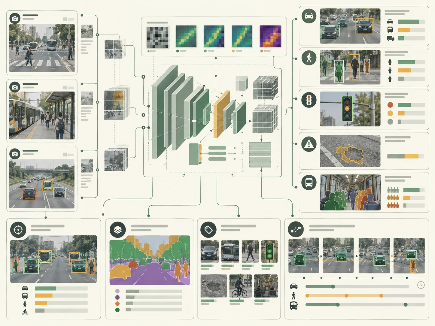
How it works
- 01Define a specific task, such as counting vehicles or detecting a blocked lane.
- 02Collect and label representative data under documented privacy and retention rules.
- 03Train or configure a model, then test it across locations, lighting, weather, and device conditions.
- 04Review outputs and failure cases with operators before connecting the model to an operational decision.
- 01
Define a specific task, such as counting vehicles or detecting a blocked lane.
- 02
Collect and label representative data under documented privacy and retention rules.
- 03
Train or configure a model, then test it across locations, lighting, weather, and device conditions.
- 04
Review outputs and failure cases with operators before connecting the model to an operational decision.
Why it matters
Image data can add observations where manual counts are infrequent, but camera placement determines whose movement is visible and what is missed. Cities need an explicit purpose, data minimization, validation, and a process for correcting errors.
Typical Smart City applications
- Vehicle, pedestrian, and cyclist counts
- Parking occupancy estimation
- Road or bridge visual inspection
- Incident detection for operator review
Example data inputs
Strengths
- Can measure repeated visual conditions at scale
- Can support more frequent inspection or counts
- Can be evaluated against labeled samples and field checks
Limitations and risks
- Performance may vary with camera angle, weather, lighting, and represented populations.
- A detection score does not establish intent, identity, or cause.
- Video collection creates privacy and security duties even when face recognition is not used.
Illustrative workflow
Applied city example
A transport team tests an intersection counter on held-out video from different times and weather. Staff compare the estimates with manual counts, review where pedestrians and cyclists are missed, and publish the system's purpose and retention limits before considering operational use.
Related methods
- Anomaly detection
- Classification
- Edge AI
- Sensor networks
Frequently asked questions
Does computer vision require identifying individuals?
No. Many tasks use aggregate counts or asset condition measures. The city should select the least identifying method that meets the stated purpose.
Can a high accuracy score guarantee safe use?
No. Evaluation must reflect the intended locations, populations, error costs, and operating conditions.
Should detections automatically trigger enforcement?
A model score alone is not sufficient. Any consequential action needs legal authority, validation, review, and a way to challenge errors.