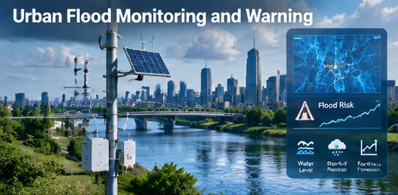
What it is
Flood monitoring combines gauges, weather observations, drainage context, terrain models, communications, and emergency procedures. A model or alert is decision support; communities need redundant warnings and plans for sensor or network failure.
How the system fits together
Physical and digital layer
Document the equipment, software, interfaces, and geographic scope as separate maintained components.
Data and identity
Record data owners, timestamps, identifiers, quality limits, access rules, and retention before combining feeds.
Operating workflow
Name the team that reviews outputs, can override automation, and remains responsible during faults or outages.
Evaluation
Compare service, equity, safety, reliability, and cost against a published baseline rather than counting installed devices.
- 01
Physical and digital layer
- 02
Data and identity
- 03
Operating workflow
- 04
Evaluation
Where cities use it
- Flash-flood warning
- Drainage operations
- Post-event analysis
- Resilience planning
Data generated
- Rainfall and water levels
- Alert and acknowledgement logs
- Terrain and drainage data
Analytics and AI applications
- Time-series forecasting
- Scenario simulation
- Geospatial risk analysis
Example in practice
Operators validate level sensors against surveyed references and define conservative escalation rules that do not depend on a single device.
Design considerations
Choose sensor placement and refresh rates from an operational need. Keep device identity, calibration, network health, and location visible to the team using the data.
Limits and risks
- Integration can concentrate security and vendor dependencies.
- Uneven coverage or stale records can make a precise interface misleading.
- A technical capability does not establish necessity, public value, or a measured outcome.